

Cape Coral.
400+ miles of canals — more than any other city in the world — platted in 1957 as a pre-cut waterfront city before the roads or the utilities existed. Everything below traces that one fact: where the water goes, and what it means for the home you buy.
Explore by category ↓Two seasons, not four.
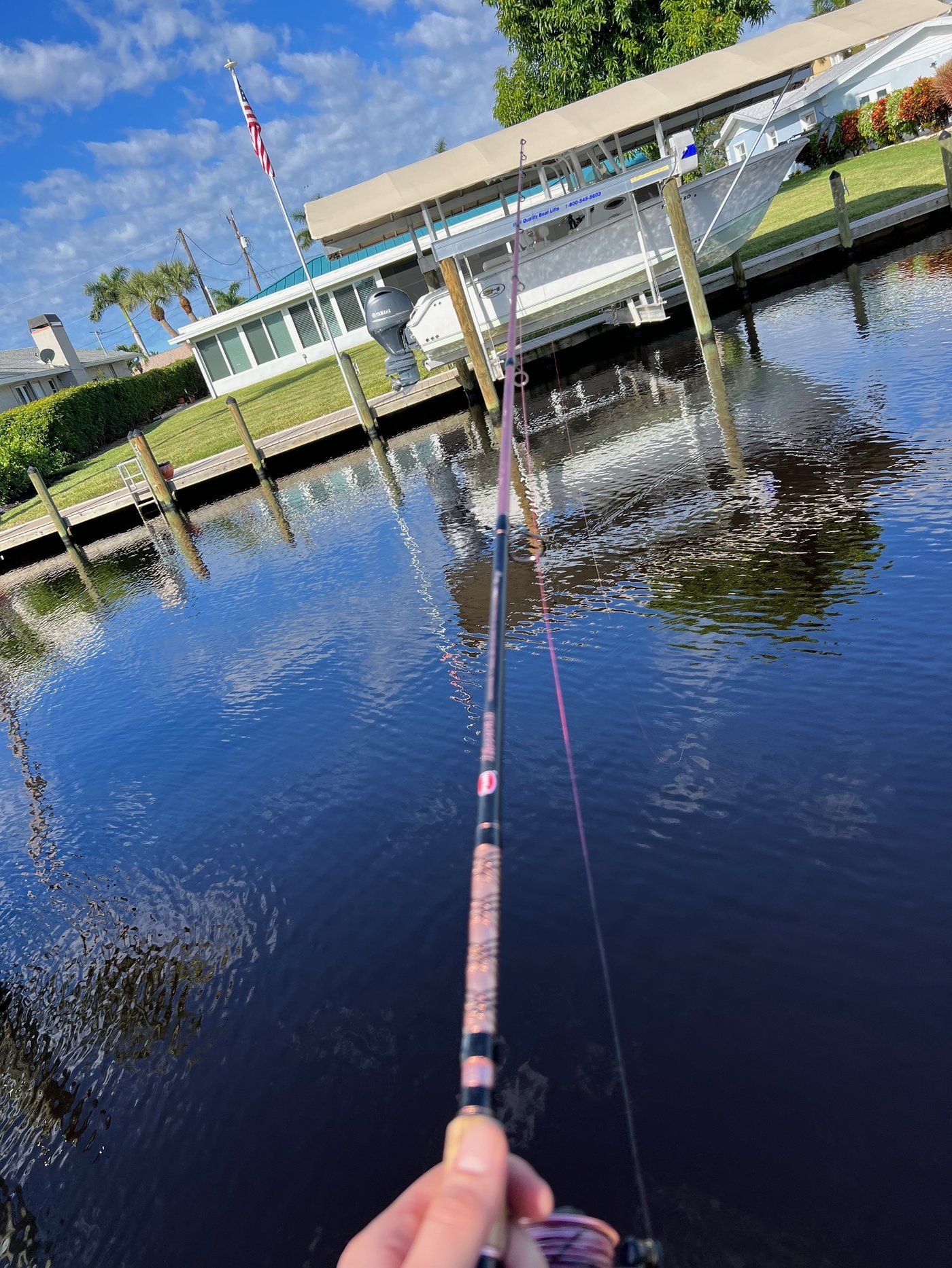
Life here runs on two seasons, not four. October through May is the version everyone posts about: mid-70s to low-80s days, low humidity, boats out every weekend, coffee on the lanai at 7am with the air almost crisp. June through September is the quieter truth — mid-90s, heat index past 105°F some afternoons, a daily thunderstorm that dumps an inch of rain in half an hour and clears by sunset. Morning and evening still belong to you; midday belongs to the AC.
Halloween to Easter, the snowbirds arrive — mostly from Michigan, Ohio, Illinois, the Northeast, and the Canadian Great Lakes provinces — and the city fills in: restaurants need reservations, bridge crossings that take ten minutes turn into twenty-five. By May it empties back out. There’s no beach inside city limits — the nearest Gulf sand is Fort Myers Beach, 30–40 minutes by car or boat. What Cape Coral has instead is the dock in the backyard, the direct run out to the Gulf, and neighbors who still wave from their boats.
Check the route to the Gulf first.
Not every one of Cape Coral’s 400+ miles of canals reaches open water. Below are three real routes pulled from the same data that powers our Waterway Map — a short run, a median run, and a long run to the Gulf.
Every quadrant has a different personality.
Cape Coral splits into four quadrants at Santa Barbara Boulevard (north–south) and Pine Island / Embers Road (east–west). Hover or tap a quadrant.
Know your ZIP code.
Cape Coral has six standard ZIP codes — 33904, 33909, 33914, 33990, 33991, and 33993 — each landing in a different quadrant with its own water type and named neighborhoods.
On Cape Coral’s canal system, VE (coastal high-hazard) exists only as narrow slivers along the outer shoreline fringe — interior canal lots, including gulf-access ones, fall in AE, X500, or X.
Watch it before you visit.
Moving to Cape Coral: the complete relocation guide
A recent Cape Coral home tour from our channel.
Read what’s useful. Skip what isn’t.
The zones, plainly.
On Cape Coral’s residential canal systems there are no V/VE coastal high-hazard zones — VE appears only in narrow slivers along the outer shoreline fringe, and the interior is sheltered behind barrier islands, so risk is driven by storm surge and rainfall, not wave action. Three FEMA zones cover nearly all of the city.
| Zone AE | The 1% annual chance flood zone (“100-year floodplain”) — roughly a 26% lifetime chance over a 30-year mortgage. Federally backed loans require flood insurance here; cash buyers don’t have to carry it. Base flood elevation is 9 ft; new construction typically builds to 11 ft. Direct gulf-access lots are almost universally Zone AE. | ~$3,000–$7,000+/yr NFIP |
|---|---|---|
| Zone X500 | The 0.2% annual chance zone (“500-year floodplain”), roughly 6% lifetime chance over 30 years. Not federally required even with a financed loan. Freshwater canal lots generally land in Zone X or X500. | ~$2,000–$3,500/yr NFIP |
| Zone X | Below 0.1% annual chance — FEMA’s lowest risk designation for Cape Coral. Not federally required. Off-water interior lots are more often Zone X. | ~$500–$1,500/yr NFIP |
| Coverage cap | NFIP building coverage caps at $250,000, contents at $100,000 — a gap on higher-value homes, addressed via private flood carriers (Neptune, Wright Flood named in our sourcing). | $250K / $100K cap |
| Elevation cert. | Roughly $500–$800 from a licensed surveyor. Documents finished-floor elevation relative to the 9-ft AE base and can support a LOMA filing to reclassify a property. | $500–$800 |
| Canal/seawall | Seawall replacement runs roughly $800–$1,200 per linear foot; a typical 80–100 ft lot runs $64,000–$120,000 full replacement, with a 30–50 year lifespan. | $800–$1,200/lin. ft |
| Map updates | FEMA updated Cape Coral’s Flood Insurance Rate Map after Hurricane Ian (2022) and again after the 2024 Helene/Milton storms; some parcels changed zones both times. Flood maps are living documents — pull the current one per parcel, not from a prior sale. | 2022 & 2024 |
Objective caveat: roughly 40% of all NFIP claims nationally come from properties in low-to-moderate-risk zones (X and X500) — a zone classification is a statistical designation, not a guarantee against flooding.
School choice, and where locals go.
Lee County uses a school-choice/lottery model, not simple neighborhood assignment — buying near a campus doesn’t guarantee placement there. Verify current boundaries at leeschools.net.
Schools near Cape Coral
- Cafferata ElementaryPreK–5 (Elementary)
- Trafalgar Middle SchoolGrades 6–8 (Middle)
- Challenger MiddleGrades 6–8 (Middle)
- Cape Coral High School (IB Programme)Grades 9–12 (High)
- Mariner High SchoolGrades 9–12 (High)
- Oasis Charter SystemSeparate charter network, own application process
- FGCU & FSWFlorida Gulf Coast University & Florida SouthWestern State College
Where locals go
- Cape HarbourDirect-gulf-access village with deep-water slips, restaurants, and boutiques.
- Rotary Park Environmental Center97-acre nature preserve with a butterfly house, 2 miles of boardwalks, and a dog park.
- Yacht Club Community BeachCape Coral's only public beach, on the Caloosahatchee River.
- Sun Splash Family WaterparkCity-run, seasonal March–September, Santa Barbara Blvd
- Four Mile Cove Ecological PreserveMangrove boardwalk on the Caloosahatchee, kayak launch
- South Cape dining corridorBackyard Social, Cork Soakers, Nice Guys Pizza, Annie’s, Iguana Mia
Cape Coral, FL · active listings in our live IDX search feed, default map view
Why I’d never leave this city.
I grew up here, and I would just never choose to leave. Every single time I go anywhere else, I want to come back. There’s nowhere as beautiful as here.
Cape Coral gives you something that almost doesn’t exist anymore in coastal Florida: direct gulf access waterfront living that’s still actually achievable. 400+ miles of canals city-wide — more than any other city in the world — and only a fraction of them actually reach the Gulf. That’s why knowing which canals do (and which don’t) matters before you fall for a listing.
Between the lifestyle, the weather, and what you actually get for it compared to anywhere else — it’s really an awesome place. The city is growing, but it still has that small-community feel. People wave on the canals. It’s the kind of place you put down roots.
Brayden Milner
Cape Coral native · 3rd-generation SWFL agent · License SL3539714
What buyers ask us about Cape Coral.
What’s the difference between direct gulf access, indirect gulf access, and freshwater?
Direct gulf access (the local MLS synonym is “sailboat access”) means no fixed bridges between your dock and open water. Sailboats with tall masts can transit freely. Indirect gulf access reaches the Gulf but the route passes under low fixed bridges (typically 8–10 ft clearance), so it’s powerboat-friendly only. Freshwater canals are landlocked: great for kayak, paddleboard, fishing, and views, but they don’t take a boat to the Gulf. The Chiquita Lock that used to gate many SW routes was permanently removed in June 2025, but fixed bridges still decide whether a route is direct or indirect. We verify per address — use our Waterway Map to check any address.
Are there any neighborhoods where the canals are freshwater?
Yes — the entire Northeast quadrant (ZIP 33909) is freshwater-only, and the interior Northwest (east of Burnt Store Road, parts of 33993) is freshwater too. These canals don’t connect to the Gulf, but they’re wide, quiet, and affordable — median prices run roughly $405,000 vs. $730,000 for Gulf-access. They’re popular with kayakers, paddleboarders, and anyone who wants water views without the Gulf-access price tag or AE-zone flood insurance. Flood zones here are X and X500, so insurance is optional and typically $500–$1,000/yr. Full guide to freshwater canals →
How long does it actually take to get from a Cape Coral canal to the Gulf?
It depends on the canal class and your starting quadrant. From a direct Gulf-access canal in SE Cape (Yacht Club or Bimini Basin), you’re looking at 25–45 minutes to open water. From SW Cape (Tarpon Point, Cape Harbour), more like 40–50 minutes. From an indirect-access canal, the fixed bridges add 10–20 minutes of no-wake canal time before you hit the river. Freshwater canals can’t reach the Gulf at all. The Chiquita Lock removal in June 2025 rerated many SW Cape canals from indirect to direct, cutting 20–30 minutes per leg for those properties. Full boat-time guide →
How much does homeowners and flood insurance actually cost?
The Cape Coral average homeowners premium runs around $2,520/year, with newer construction often coming in under $1,500/year when the home has a recent roof, impact windows or shutters, and elevated build. Flood insurance is separate and ranges widely by zone (AE, X500, X), elevation, and whether an existing NFIP policy is assumable. The variables that move the number are roof age, construction type, flood zone, elevation, claim history, wind mitigation, and 4-point inspection. Always quote insurance before you write an offer.
What about the seawall? How do I know it’s sound?
The seawall is one of the biggest carrying-cost surprises on a Cape Coral canal home. Replacement runs roughly $800–$1,200 per linear foot, so a typical 80–100 ft lot can mean $64,000–$120,000 for a full replacement, with a 30–50 year lifespan. What we check: age of the wall, visible cracking or bowing, weep-hole condition, cap condition, and whether the seller can produce permit history. We pull the city’s seawall and permit records during due diligence on every canal offer.
How does hurricane risk affect Cape Coral?
Cape Coral has real Gulf Coast hurricane exposure: Charley 2004, Irma 2017, Ian 2022, Helene and Milton 2024. Ian was the modern outlier, with the worst flooding concentrated around southern waterfront areas, the Yacht Club, and parts east of Del Prado; many other parts of the city did not flood. The honest frame is property-specific risk, not blanket fear: construction era, concrete block, roof age, impact windows, slab elevation, and post-Ian code upgrades all change the picture on a specific home. Quote insurance early, know the zone and elevation, and have a plan.
You’ve reached the Gulf
Book a 15–30 minute intro call.
We’ll walk through what’s relevant to where you are now and what you’re trying to do. No pitch. No pressure. Just a real conversation with someone who grew up in this market.
- Quadrant matched to your boat, lifestyle, and budget
- Flood zone, insurance, and assessment clarity up front
- School choice and tax-reset context for relocators
Tell us about your situation.
Real conversation. No pressure. No call-center handoff.
Send Us a Message
We usually respond the same business day.